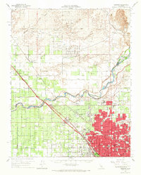
1965 Map of Herndon
USGS Topo · Published 1967About this map
The San Joaquin River carves a winding path through the center of this mid-1960s landscape, serving as the physical boundary between Madera and Fresno counties. The southern half of the sheet is dominated by the rapid expansion of Fresno, showing a dense urban grid that includes major educational and religious landmarks such as Fresno State College, St Agnes Hospital, and Roosevelt High Sch. The region's agricultural and transit roots are evidenced by the prominent corridors of the Atchison Topeka and Santa Fe and Southern Pacific railroads, which support smaller agricultural hubs like Herndon, Gregg, and Irrigosa. Extensive irrigation infrastructure, including the Madera Canal and Herndon Canal, illustrates the engineered water systems essential to the San Joaquin Valley. To the north, the terrain transitions into more open ranch land and orchards, punctuated by family-named landmarks like Circle M Ranch.
Find a feature on this map
77 named features on this map. Tap any name to fly to it.
Don’t see what you’re looking for? This feature index may not catch every label — zoom into the map to look around manually.
Map Details
Editions of this 1965 Herndon Map
This is the sole edition of this map. No revisions or reprints were ever made.
Other maps of this area

1912 · Mariposa
USGS Topo · 1:125,000

1916 · Sulphur Springs
USGS Topo · 1:24,000

1919 · Sulphur Springs
USGS Topo · 1:31,680

1919 · Little Table Mountain
USGS Topo · 1:31,680

1920 · Kismet
USGS Topo · 1:31,680

1921 · Daulton
USGS Topo · 1:31,680

1921 · Bullard
USGS Topo · 1:31,680

1922 · Lanes Bridge
USGS Topo · 1:31,680

1922 · Friant
USGS Topo · 1:31,680

1922 · Gregg
USGS Topo · 1:31,680