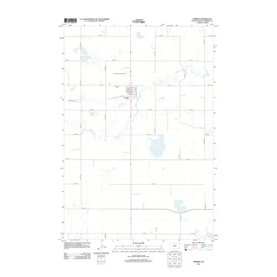
2012 Map of Herreid
USGS Topo · Published 2012About this map
Herreid serves as the central hub of this Campbell County survey, where a neat grid of residential streets like Pine St and Dyke St transitions into the expansive agricultural landscape of northern South Dakota. The town's infrastructure is anchored by the Herreid Municipal Airport to the northwest and the Fairview Cem just outside the main residential blocks. The surrounding terrain is defined by its subtle drainage patterns, notably the winding path of Spring Cr which meanders through the township. Several significant water bodies dot the prairie, including McClarem Lake and Big Lake in the southern reaches. The map reveals a strictly organized section-line road system, with thoroughfares such as 304th Ave and 110th St forming the backbone of the region's transport network, facilitating the movement of local agricultural products.
Find a feature on this map
31 named features on this map. Tap any name to fly to it.
Don’t see what you’re looking for? This feature index may not catch every label — zoom into the map to look around manually.
Map Details
Editions of this 2012 Herreid Map
This is the sole edition of this map. No revisions or reprints were ever made.
Other maps of this area

1953 · McIntosh
USGS Topo · 1:250,000

1954 · Aberdeen
USGS Topo · 1:250,000

1956 · Aberdeen
USGS Topo · 1:250,000

1958 · McIntosh
USGS Topo · 1:250,000

1965 · Herreid NW
USGS Topo · 1:24,000

1965 · Herreid SW
USGS Topo · 1:24,000

1965 · Herreid NE
USGS Topo · 1:24,000

1965 · Herreid
USGS Topo · 1:24,000

1967 · Mound City
USGS Topo · 1:24,000

1967 · Selby NW
USGS Topo · 1:24,000