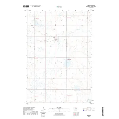
2017 Map of Herreid
USGS Topo · Published 2017About this map
Herreid occupies the central northern reaches of this Campbell County survey, serving as a concentrated hub of activity amidst a landscape dominated by prairie wetlands and small glacial basins. The town grid is clearly defined, situated just south of the Herreid Municipal Airport and flanked by local burial grounds including Fairview Cem and Saint Michaels Catholic Cem. This 2017 study reflects a rural infrastructure built around section-line roads like 108th ST and 112th ST that navigate around numerous unnamed potholes and basins characteristic of the region. Significant water features such as McClarem Lake and the meandering Spring Creek break the geometric regularity of the township and range system, providing vital drainage for the surrounding agricultural lands.
Find a feature on this map
28 named features on this map. Tap any name to fly to it.
Don’t see what you’re looking for? This feature index may not catch every label — zoom into the map to look around manually.
Map Details
Editions of this 2017 Herreid Map
This is the sole edition of this map. No revisions or reprints were ever made.
Other maps of this area

1953 · McIntosh
USGS Topo · 1:250,000

1954 · Aberdeen
USGS Topo · 1:250,000

1956 · Aberdeen
USGS Topo · 1:250,000

1958 · McIntosh
USGS Topo · 1:250,000

1965 · Herreid NW
USGS Topo · 1:24,000

1965 · Herreid SW
USGS Topo · 1:24,000

1965 · Herreid NE
USGS Topo · 1:24,000

1965 · Herreid
USGS Topo · 1:24,000

1967 · Mound City
USGS Topo · 1:24,000

1967 · Selby NW
USGS Topo · 1:24,000