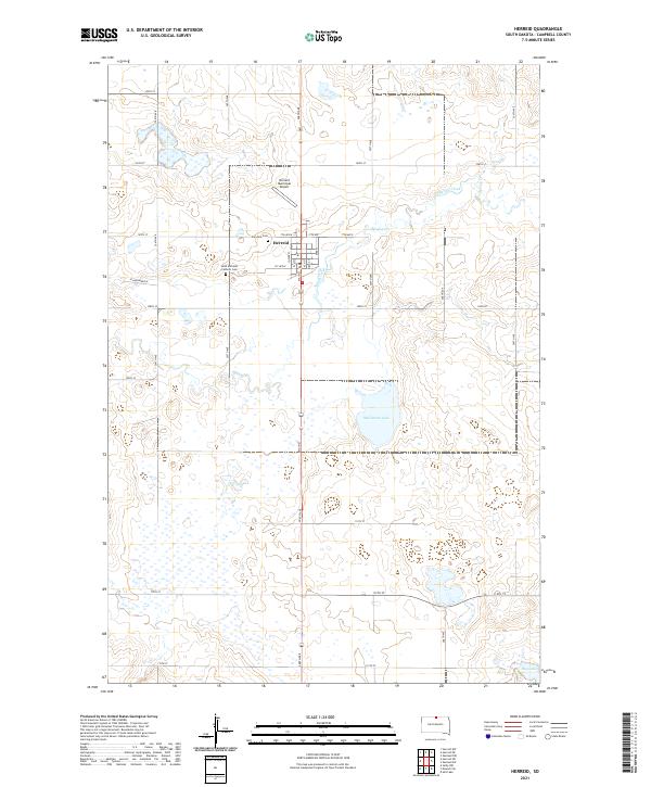
2021 Map of Herreid
USGS Topo · Published 2021About this map
Herreid stands as the primary hub of this Campbell County landscape, situated along the intersection of Main St and 7th Ave. The town’s layout reflects a classic Midwestern agricultural grid, supported by the Herreid Municipal Airport to the north and various local cemeteries such as Fairview Cem and Saint Michaels Catholic Cem, which offer significant value for genealogical research. The surrounding terrain is defined by a complex network of seasonal wetlands and prairie potholes characteristic of the Missouri Plateau. Spring Cr meanders across the central township, eventually feeding toward larger water bodies like McClarem Lake and Big Lake in the south. This survey documents the modern rural infrastructure of the region, from the strictly aligned section-line roads like 306th Ave to the residential streets of the town center.
Find a feature on this map
39 named features on this map. Tap any name to fly to it.
Don’t see what you’re looking for? This feature index may not catch every label — zoom into the map to look around manually.
Map Details
Editions of this 2021 Herreid Map
This is the sole edition of this map. No revisions or reprints were ever made.
Other maps of this area

1953 · McIntosh
USGS Topo · 1:250,000

1954 · Aberdeen
USGS Topo · 1:250,000

1956 · Aberdeen
USGS Topo · 1:250,000

1958 · McIntosh
USGS Topo · 1:250,000

1965 · Herreid NW
USGS Topo · 1:24,000

1965 · Herreid SW
USGS Topo · 1:24,000

1965 · Herreid NE
USGS Topo · 1:24,000

1965 · Herreid
USGS Topo · 1:24,000

1967 · Mound City
USGS Topo · 1:24,000

1967 · Selby NW
USGS Topo · 1:24,000