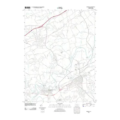
2010 Map of Hershey
USGS Topo · Published 2010About this map
Hummelstown and the residential layout of Oakmont anchor the southwestern portion of this landscape, where the Swatara Creek winds past the Hummelstown Dam. This 2010 survey illustrates a region defined by extensive leisure and institutional land use, specifically the concentration of landmark properties associated with the Hershey legacy. To the northeast, The Hotel Hershey and its associated Hotel Hershey Golf Course sit near the Hershey Nursery and Hershey Air Park. The map documents a blend of transit and recreation, showing Brookside Farms Airport tucked between Manada Creek and Kellock Run. Local history is preserved through sites like Resurrection Cemetery and the Hershey Cemetery, while modern infrastructure is represented by the State Police Area Three Airport near the southern boundary.
Find a feature on this map
84 named features on this map. Tap any name to fly to it.
Don’t see what you’re looking for? This feature index may not catch every label — zoom into the map to look around manually.
Map Details
Editions of this 2010 Hershey Map
This is the sole edition of this map. No revisions or reprints were ever made.
Other maps of this area

1892 · Hummelstown
USGS Topo · 1:62,500

1892 · Harrisburg
USGS Topo · 1:62,500

1899 · Harrisburg
USGS Topo · 1:62,500

1906 · New Cumberland
USGS Topo · 1:62,500

1908 · Middletown
USGS Topo · 1:62,500

1924 · Hummelstown
USGS Topo · 1:62,500

1924 · Harrisburg
USGS Topo · 1:62,500

1943 · New Cumberland
USGS Topo · 1:62,500

1943 · Middletown
USGS Topo · 1:62,500

1943 · Harrisburg
USGS Topo · 1:62,500
Featured Places
- Hershey, Derry Township
- Rutherford, Swatara Township
- Skyline View, West Hanover Township
- Hummelstown, PA
- East Hanover Township, PA