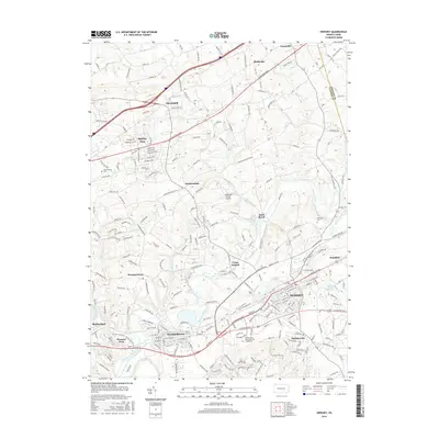
2016 Map of Hershey
USGS Topo · Published 2016About this map
The sprawling suburban and industrial character of central Pennsylvania is on full display in this 2016 survey, where the town of Hershey serves as a major hub. The landscape is defined by its transit corridors and the winding path of Swatara Creek, which flows past the established borough of Hummelstown and the village of Union Deposit. The map documents a blend of academic, medical, and agricultural land uses, notably featuring the Pennsylvania State Univ Coll of Medicine campus. Smaller residential pockets such as Hockersville, Palmdale, and Hoernerstown are interspersed among the larger settlements. Local history is traced through sites like the Hershey Cem and the Brookside Farms Airport, while modern infrastructure like W Chocolate Ave and Allentown Blvd connects these historic communities across the Dauphin Co and Lebanon Co border.
Find a feature on this map
57 named features on this map. Tap any name to fly to it.
Don’t see what you’re looking for? This feature index may not catch every label — zoom into the map to look around manually.
Map Details
Editions of this 2016 Hershey Map
This is the sole edition of this map. No revisions or reprints were ever made.
Other maps of this area

1892 · Hummelstown
USGS Topo · 1:62,500

1892 · Harrisburg
USGS Topo · 1:62,500

1899 · Harrisburg
USGS Topo · 1:62,500

1906 · New Cumberland
USGS Topo · 1:62,500

1908 · Middletown
USGS Topo · 1:62,500

1924 · Hummelstown
USGS Topo · 1:62,500

1924 · Harrisburg
USGS Topo · 1:62,500

1943 · New Cumberland
USGS Topo · 1:62,500

1943 · Middletown
USGS Topo · 1:62,500

1943 · Harrisburg
USGS Topo · 1:62,500
Featured Places
- Hershey, Derry Township
- Rutherford, Swatara Township
- Skyline View, West Hanover Township
- Hummelstown, PA
- East Hanover Township, PA