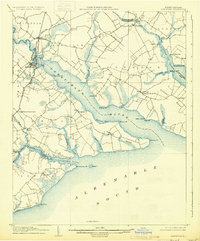
1906 Map of Hertford
USGS Topo · Published 1930About this map
Hertford serves as the focal point of this coastal North Carolina landscape, where the Norfolk and Southern railroad crosses the Perquimans River to connect the region's agricultural interior with the Albemarle Sound. The 1902–1904 survey reveals an intricate network of peninsulas or "necks," such as Durant Neck and Harvey Neck, which defined the economy and transit of the era. These landforms are dotted with small post offices and landings, including Durants Neck PO and Redbank Ldg, illustrating a time when water travel was as vital as the emerging rail lines.
Find a feature on this map
55 named features on this map. Tap any name to fly to it.
Don’t see what you’re looking for? This feature index may not catch every label — zoom into the map to look around manually.
Map Details
Editions of this 1906 Hertford Map
3 editions found
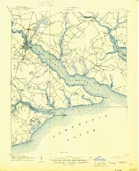
Other maps of this area

1904 · Edenton
USGS Topo · 1:62,500

1906 · Hertford
USGS Topo · 1:62,500

1906 · Beckford
USGS Topo · 1:48,000

1907 · Beckford
USGS Topo · 1:62,500

1940 · Hertford
USGS Topo · 1:62,500

1940 · Beckford
USGS Topo · 1:62,500

1940 · Wade Point
USGS Topo · 1:62,500

1940 · South Mills
USGS Topo · 1:62,500

1942 · Edenton
USGS Topo · 1:62,500

1943 · Wade Point
USGS Topo · 1:62,500