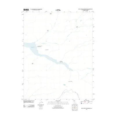
2012 Map of Hetch Hetchy Reservoir
USGS Topo · Published 2012About this map
Hetch Hetchy Reservoir dominates this landscape, where the inundated valley floor is surrounded by prominent granite features like Smith Peak and Le Conte Point. The hydrology of this portion of Tuolumne County is marked by the convergence of Tiltill Cr and Rancheria Cr, which feed into the reservoir from the north. The rugged transition between the high sierra and the canyon floor is visible through landmarks such as Rancheria Falls and the Grand Canyon of the Tuolumne River. In the southern reaches, the Middle Tuolumne River winds near Harden Lake and the open flats of Harden Gardens. The map also captures historical transportation corridors, including portions of the Old Tioga Rd and White Wolf Rd, which provide access to this high-elevation wilderness.
Find a feature on this map
19 named features on this map. Tap any name to fly to it.
Don’t see what you’re looking for? This feature index may not catch every label — zoom into the map to look around manually.
Map Details
Editions of this 2012 Hetch Hetchy Reservoir Map
This is the sole edition of this map. No revisions or reprints were ever made.
Other maps of this area

1896 · Dardanelles
USGS Topo · 1:125,000

1897 · Yosemite
USGS Topo · 1:125,000

1898 · Dardanelles
USGS Topo · 1:125,000

1900 · Yosemite
USGS Topo · 1:125,000

1903 · Yosemite
USGS Topo · 1:125,000

1909 · Yosemite
USGS Topo · 1:125,000

1947 · Mariposa
USGS Topo · 1:250,000

1948 · Walker Lake
USGS Topo · 1:250,000

1948 · Mariposa
USGS Topo · 1:250,000

1956 · Pinecrest
USGS Topo · 1:62,500