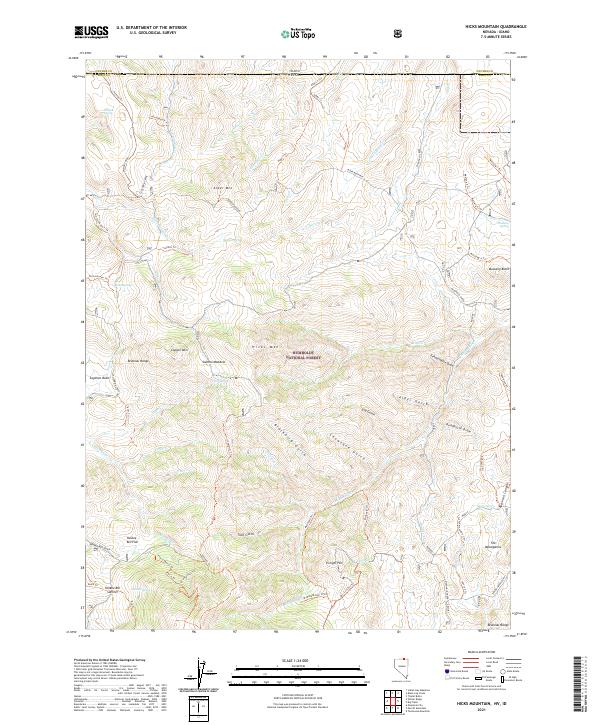
2021 Map of Hicks Mountain
USGS Topo · Published 2021About this map
Humboldt National Forest encompasses this high-altitude landscape along the Nevada-Idaho border, where the Bruneau Range meets the drainages of the Owyhee and Elko counties. The terrain is defined by a series of prominent peaks and meadows, including Alder Mtn and the expansive Salmon Meadow. The map reveals a complex network of equestrian and hiking routes, such as the Horse Haven Trl and Summit Trl, which navigate the steep gullies of Blackbird Gulch and Snowshoe Gulch.
Find a feature on this map
84 named features on this map. Tap any name to fly to it.
Don’t see what you’re looking for? This feature index may not catch every label — zoom into the map to look around manually.
Map Details
Editions of this 2021 Hicks Mountain Map
This is the sole edition of this map. No revisions or reprints were ever made.
Other maps of this area

1936 · Mountain City
USGS Topo · 1:62,500

1936 · Rowland
USGS Topo · 1:48,000

1940 · Rowland
USGS Topo · 1:62,500

1940 · Mountain City
USGS Topo · 1:62,500

1955 · Twin Falls
USGS Topo · 1:250,000

1955 · Wells
USGS Topo · 1:250,000

1958 · Wells
USGS Topo · 1:250,000

1958 · Twin Falls
USGS Topo · 1:250,000

1961 · Wells
USGS Topo · 1:250,000
1979 · Indian Hay Meadows
USGS Topo · 1:24,000