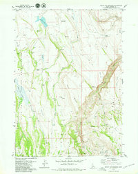
1979 Map of Indian Hay Meadows
USGS Topo · Published 1979About this map
Duck Valley Indian Reservation dominates the western half of this landscape, where the Indian Hay Meadows and Buck Pasture lie along the upper drainage of Snow Creek. The terrain is characterized by high desert ranching outposts and seasonal camps, evidenced by numerous named family sites such as Parker Place, Ratliff Place, and the Dew Drop Place.
Find a feature on this map
39 named features on this map. Tap any name to fly to it.
Don’t see what you’re looking for? This feature index may not catch every label — zoom into the map to look around manually.
Map Details
Editions of this 1979 Indian Hay Meadows Map
This is the sole edition of this map. No revisions or reprints were ever made.
Other maps of this area

1936 · Mountain City
USGS Topo · 1:62,500

1939 · Owyhee
USGS Topo · 1:62,500

1940 · Mountain City
USGS Topo · 1:62,500

1942 · Owyhee
USGS Topo · 1:62,500

1955 · McDermitt
USGS Topo · 1:250,000

1955 · Jordan Valley
USGS Topo · 1:250,000

1955 · Twin Falls
USGS Topo · 1:250,000

1955 · Wells
USGS Topo · 1:250,000

1957 · Jordan Valley
USGS Topo · 1:250,000

1958 · Wells
USGS Topo · 1:250,000