
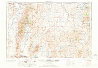
1955 Map of McDermitt
USGS Topo · Published 1955About this map
The Fort McDermitt Ind Res and Duck Valley Indian Reservation anchor the northern landscape of this 1955 survey, where the Great Basin high desert meets the Oregon and Idaho borders. Mining operations define the economic history of the region, specifically at the Cordero Mine near the settlement of McDermitt and the National Mine situated in the western ranges. The terrain transitions from the broad Silver State Valley and Eden Valley to the dramatic heights of the Osgood Mountains and the Humboldt National Forest. Settlements like Tuscarora and Orovada are connected by a network of ranching roads that follow drainage patterns like the Quinn River and Little Humboldt River. The map also captures critical water management features for the arid interior, including Chimney Creek Reservoir and Wilson Reservoir.
Find a feature on this map
114 named features on this map. Tap any name to fly to it.
Don’t see what you’re looking for? This feature index may not catch every label — zoom into the map to look around manually.
Map Details
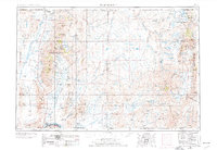
Editions of this 1955 McDermitt Map
3 editions found
Other maps of this area

1882 · Paradise
USGS Topo · 1:250,000

1886 · Disaster
USGS Topo · 1:250,000

1893 · Paradise
USGS Topo · 1:250,000

1893 · Disaster
USGS Topo · 1:250,000

1931 · Lovelock
USGS Topo · 1:250,000

1932 · Sonoma Range
USGS Topo · 1:250,000

1935 · Lovelock
USGS Topo · 1:250,000

1936 · Mountain City
USGS Topo · 1:62,500

1939 · Sonoma Range
USGS Topo · 1:250,000

1939 · Owyhee
USGS Topo · 1:62,500