
1882 Map of Paradise
USGS Topo · Published 1882About this map
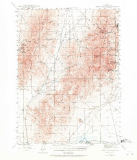
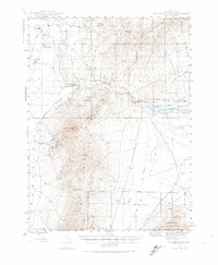
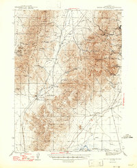
Paradise City serves as the focal point of this northern Nevada landscape, established within the high-desert valleys between the Santa Rosa Mountains and the Slumbering Hills. The geography is defined by a series of isolated stations—including Cane Springs Station, Flynn Station, and Willow Point Station—that supported overland travel before more extensive development took hold. This early survey, led by geologist G.K. Gilbert, documents a complex hydraulic network where the Quinn River and the Little Humboldt River carve through the basin and range terrain.
Find a feature on this map
36 named features on this map. Tap any name to fly to it.
Don’t see what you’re looking for? This feature index may not catch every label — zoom into the map to look around manually.
Map Details
Editions of this 1882 Paradise Map
This is the sole edition of this map. No revisions or reprints were ever made.
Other maps of this area

1886 · Disaster
USGS Topo · 1:250,000

1893 · Paradise
USGS Topo · 1:250,000

1893 · Disaster
USGS Topo · 1:250,000

1931 · Lovelock
USGS Topo · 1:250,000

1932 · Sonoma Range
USGS Topo · 1:250,000

1935 · Lovelock
USGS Topo · 1:250,000

1939 · Sonoma Range
USGS Topo · 1:250,000
1945 · Osgood Mountains
USGS Topo · 1:62,500
1945 · Hot Springs
USGS Topo · 1:62,500
1947 · Osgood Mountains
USGS Topo · 1:62,500