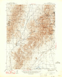
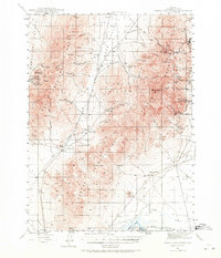
1947 Map of Osgood Mountains
USGS Topo · Published 1947About this map
Mining operations and high-desert ranching define this mid-century landscape in the Osgood Mountains and Hot Springs Range. The survey documents a critical period for local industry, featuring the Getchell Mine, Riley Mine, and Mountain View Mine as focal points of activity. In the lowlands, the Humboldt River flows near the Western Pacific railroad tracks at the rail stop of Comus. Remote family holdings such as the Yribarne Bros Ranch, Frazier Ranch, and Hugh Bains Ranch are scattered across the terrain, connected by the Burma Road and various dirt tracks. Unique landmarks like the Stone Corral and Anderson Gardens appear alongside numerous springs, including Goughs Spring and Dalveda Spr, which sustained life in the arid Paradise Valley and Eden Valley.
Find a feature on this map
54 named features on this map. Tap any name to fly to it.
Don’t see what you’re looking for? This feature index may not catch every label — zoom into the map to look around manually.
Map Details
Editions of this 1947 Osgood Mountains Map
This is the sole edition of this map. No revisions or reprints were ever made.
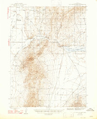
Other maps of this area

1882 · Paradise
USGS Topo · 1:250,000

1893 · Paradise
USGS Topo · 1:250,000

1932 · Sonoma Range
USGS Topo · 1:250,000

1939 · Sonoma Range
USGS Topo · 1:250,000
1945 · Osgood Mountains
USGS Topo · 1:62,500
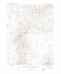
1945 · Hot Springs
USGS Topo · 1:62,500
1947 · Hot Springs Peak
USGS Topo · 1:62,500

1955 · McDermitt
USGS Topo · 1:250,000

1955 · Winnemucca
USGS Topo · 1:250,000

1958 · Winnemucca
USGS Topo · 1:250,000