
1958 Map of Winnemucca
USGS Topo · Published 1958About this map
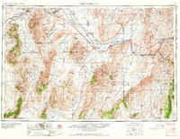
The Humboldt River corridor serves as the primary artery through this high-desert basin and range landscape, shadowed by the dual tracks of the Southern Pacific and Western Pacific railroads. Centered on the hub of Winnemucca, the map documents a mid-century mining economy in transition, with active and legacy sites like the Adelaide Crown Mines and Copper Canyon Mine scattered through the surrounding ranges. The settlement pattern reflects the harsh geography, with clusters around rail stops like Battle Mountain and Beowawe, and remote outposts such as Unionville and Rochester tucked into the mountain folds. Significant topographic landmarks, including Sonoma Peak and Mount Tobin, define the vast valleys of Pumpernickel Valley and Buffalo Valley, while the Reese River and Rock Creek provide vital, if intermittent, water sources for the ranches established along the basin floors.
Find a feature on this map
111 named features on this map. Tap any name to fly to it.
Don’t see what you’re looking for? This feature index may not catch every label — zoom into the map to look around manually.
Map Details
Editions of this 1958 Winnemucca Map
2 editions found
Other maps of this area

1882 · Paradise
USGS Topo · 1:250,000

1886 · Disaster
USGS Topo · 1:250,000

1893 · Paradise
USGS Topo · 1:250,000

1893 · Disaster
USGS Topo · 1:250,000

1908 · Carson Sink
USGS Topo · 1:250,000

1910 · Carson Sink
USGS Topo · 1:250,000

1926 · Roberts Mountains
USGS Topo · 1:250,000

1929 · Roberts Mountains
USGS Topo · 1:250,000

1931 · Lovelock
USGS Topo · 1:250,000

1932 · Sonoma Range
USGS Topo · 1:250,000