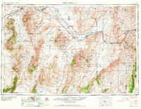
1958 Map of Winnemucca
USGS Topo · Published 1958About this map
Winnemucca and Battle Mountain serve as the primary hubs along the Humboldt River corridor during the mid-1950s, a period defined by the enduring presence of the Southern Pacific and Western Pacific railroads. The landscape is a sequence of high desert basins and north-south mountain ranges, including the Sonoma Range and Shoshone Mountains. Mining activity is extensive but transitioning, as evidenced by several marked locations such as the Adelaide Mine (abandoned) and Marigold Mine (abandoned).
Find a feature on this map
106 named features on this map. Tap any name to fly to it.
Don’t see what you’re looking for? This feature index may not catch every label — zoom into the map to look around manually.
Map Details
Editions of this 1958 Winnemucca Map
2 editions found

Other maps of this area

1882 · Paradise
USGS Topo · 1:250,000

1886 · Disaster
USGS Topo · 1:250,000

1893 · Paradise
USGS Topo · 1:250,000

1893 · Disaster
USGS Topo · 1:250,000

1908 · Carson Sink
USGS Topo · 1:250,000

1910 · Carson Sink
USGS Topo · 1:250,000

1926 · Roberts Mountains
USGS Topo · 1:250,000

1929 · Roberts Mountains
USGS Topo · 1:250,000

1931 · Lovelock
USGS Topo · 1:250,000

1932 · Sonoma Range
USGS Topo · 1:250,000