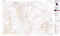
1986 Map of Winnemucca
USGS Topo · Published 1986About this map
The Humboldt River carves a critical path through this high-desert landscape, serving as the primary corridor for the Southern Pacific and Western Pacific railroads. Centered on the city of Winnemucca, the map details a region defined by industrial extraction and transit. The Winnemucca Indian Colony sits just east of the city, while the surrounding ranges, including the Sonoma Range and East Range, are dotted with mining operations such as the Adelaide Mine and Silver King Mine.
Find a feature on this map
42 named features on this map. Tap any name to fly to it.
Don’t see what you’re looking for? This feature index may not catch every label — zoom into the map to look around manually.
Map Details
Editions of this 1986 Winnemucca Map
This is the sole edition of this map. No revisions or reprints were ever made.
Other maps of this area

1882 · Paradise
USGS Topo · 1:250,000

1886 · Disaster
USGS Topo · 1:250,000

1893 · Paradise
USGS Topo · 1:250,000

1893 · Disaster
USGS Topo · 1:250,000

1931 · Lovelock
USGS Topo · 1:250,000

1932 · Sonoma Range
USGS Topo · 1:250,000

1935 · Lovelock
USGS Topo · 1:250,000

1939 · Sonoma Range
USGS Topo · 1:250,000

1939 · Eugene Mountains Area
USGS Topo · 1:62,500

1940 · Antler Peak
USGS Topo · 1:62,500