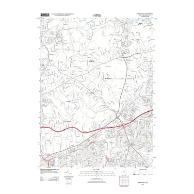
2013 Map of Hicksville
USGS Topo · Published 2013About this map
The North Shore of Long Island, historically defined by its prestigious estates and early settlements, is captured here in detail. The landscape transitions from the coastal waters of Oyster Bay and Long Island Sound at Weeks Point down to the densely developed residential and commercial hubs of the interior. Large landholdings and equestrian-oriented properties are evident in Muttontown, Brookville, and Old Westbury, where Old Westbury Pond serves as a local landmark.
Find a feature on this map
34 named features on this map. Tap any name to fly to it.
Don’t see what you’re looking for? This feature index may not catch every label — zoom into the map to look around manually.
Map Details
Editions of this 2013 Hicksville Map
This is the sole edition of this map. No revisions or reprints were ever made.
Other maps of this area

1897 · Hempstead
USGS Topo · 1:62,500

1897 · Oyster Bay
USGS Topo · 1:62,500

1898 · Hempstead
USGS Topo · 1:62,500

1898 · Oyster Bay
USGS Topo · 1:62,500

1899 · Hempstead
USGS Topo · 1:62,500

1900 · Oyster Bay
USGS Topo · 1:62,500

1901 · Babylon
USGS Topo · 1:62,500

1901 · Northport
USGS Topo · 1:62,500

1903 · Babylon
USGS Topo · 1:62,500

1903 · Northport
USGS Topo · 1:62,500