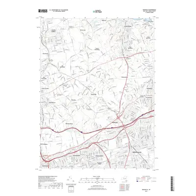
2019 Map of Hicksville
USGS Topo · Published 2019About this map
Hicksville and the surrounding north shore communities of Nassau County are depicted in this 2019 survey, showing a landscape defined by dense residential development and institutional expansion. Educational campuses occupy significant portions of the terrain, including Long Island University Post Campus and the SUNY College at Old Westbury. The map reveals a high concentration of memorial sites and family plots near Oyster Bay, most notably the Theodore Roosevelt Grave and the Youngs Memorial Cem.
Find a feature on this map
106 named features on this map. Tap any name to fly to it.
Don’t see what you’re looking for? This feature index may not catch every label — zoom into the map to look around manually.
Map Details
Editions of this 2019 Hicksville Map
This is the sole edition of this map. No revisions or reprints were ever made.
Other maps of this area

1897 · Hempstead
USGS Topo · 1:62,500

1897 · Oyster Bay
USGS Topo · 1:62,500

1898 · Hempstead
USGS Topo · 1:62,500

1898 · Oyster Bay
USGS Topo · 1:62,500

1899 · Hempstead
USGS Topo · 1:62,500

1900 · Oyster Bay
USGS Topo · 1:62,500

1901 · Babylon
USGS Topo · 1:62,500

1901 · Northport
USGS Topo · 1:62,500

1903 · Babylon
USGS Topo · 1:62,500

1903 · Northport
USGS Topo · 1:62,500