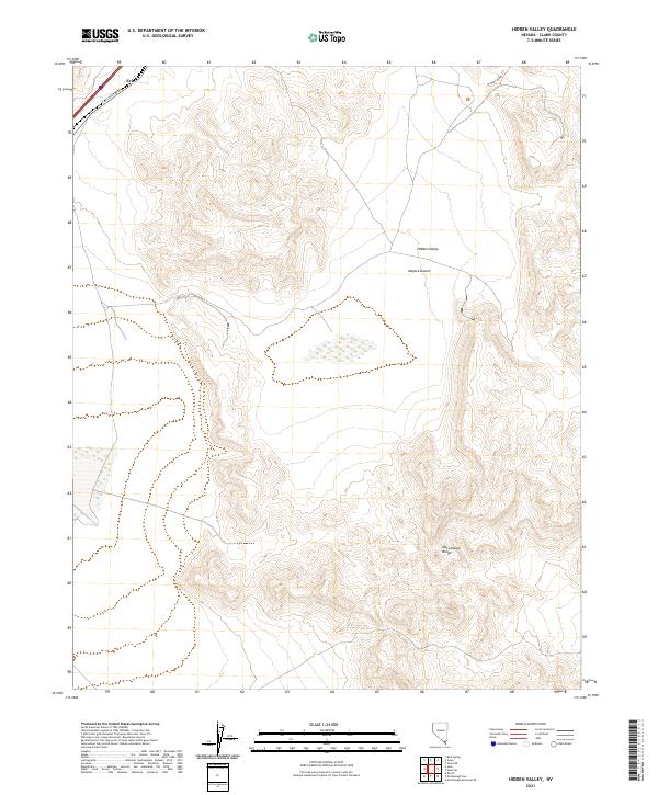
2021 Map of Hidden Valley
USGS Topo · Published 2021About this map
Mojave Desert terrain and the high ridges of the McCullough Range define this arid landscape southeast of the Las Vegas valley. In the northwestern corner, the transit corridor of S Las Vegas Blvd passes through the settlement of Eric, while the eponymous Hidden Valley occupies the central basin. This 2021 survey illustrates a region largely characterized by its topography and desert tracks, including the Hidden Valley Trl. The mapping of township and range lines like t24s r61e provides a precise grid for local history researchers studying land use and property boundaries in this section of Clark County.
Find a feature on this map
10 named features on this map. Tap any name to fly to it.
Don’t see what you’re looking for? This feature index may not catch every label — zoom into the map to look around manually.
Map Details
Editions of this 2021 Hidden Valley Map
This is the sole edition of this map. No revisions or reprints were ever made.
Other maps of this area

1910 · Ivanpah
USGS Topo · 1:250,000

1912 · Ivanpah
USGS Topo · 1:250,000

1942 · Ivanpah
USGS Topo · 1:250,000

1947 · Kingman
USGS Topo · 1:250,000

1948 · Kingman
USGS Topo · 1:250,000

1954 · Kingman
USGS Topo · 1:250,000

1955 · Kingman
USGS Topo · 1:250,000

1955 · Roach Lake
USGS Topo · 1:62,500

1958 · Kingman
USGS Topo · 1:250,000

1960 · Kingman
USGS Topo · 1:250,000