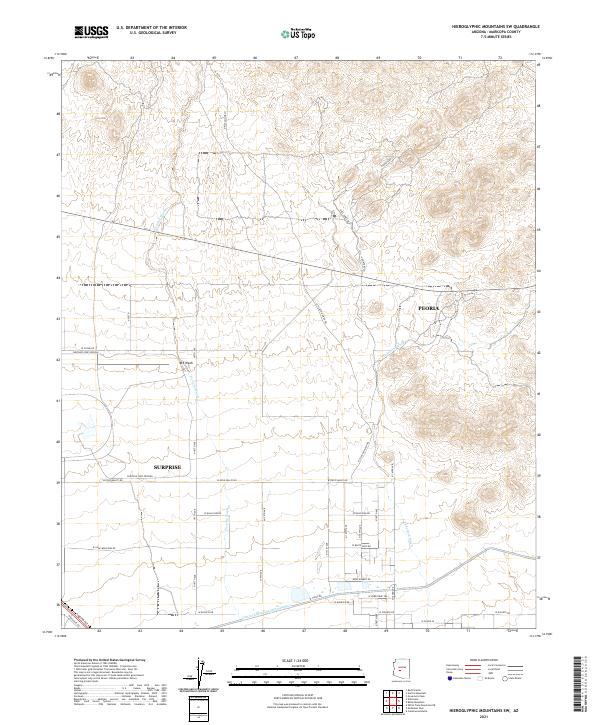
2021 Map of Hieroglyphic Mountains SW
USGS Topo · Published 2021About this map
The arid alluvial plains north of Surprise and Peoria are characterized by a network of braided seasonal drainages, most notably Picacho Wash and Padeford Wash. This modern topographical survey shows a landscape defined by rapid suburban expansion and major infrastructure projects. The massive Central Arizona Project Aqueduct cuts across the southern portion of the quadrangle, accompanied by W Canal Rd, serving as a critical water artery for the desert region. To the west, the specialized facility of the Chrysler Corp Proving grounds occupies a significant footprint, contrasting with the emerging residential grid. Local transport is represented by the diagonal route of W Grand Ave in the southwest corner, while the northern sections remain largely undeveloped desert terrain marked by trails like the N Picacho Wash Trl.
Find a feature on this map
39 named features on this map. Tap any name to fly to it.
Don’t see what you’re looking for? This feature index may not catch every label — zoom into the map to look around manually.
Map Details
Editions of this 2021 Hieroglyphic Mountains SW Map
This is the sole edition of this map. No revisions or reprints were ever made.
Other maps of this area

1954 · Phoenix
USGS Topo · 1:250,000

1957 · Phoenix
USGS Topo · 1:250,000

1957 · White Tank Mts. NE
USGS Topo · 1:24,000

1957 · Calderwood Butte
USGS Topo · 1:24,000

1957 · McMicken Dam
USGS Topo · 1:24,000

1957 · White Tank Mts.
USGS Topo · 1:62,500

1958 · Phoenix
USGS Topo · 1:250,000

1960 · Phoenix
USGS Topo · 1:250,000
1964 · Garfias Mountain
USGS Topo · 1:24,000
1964 · Red Picacho
USGS Topo · 1:24,000