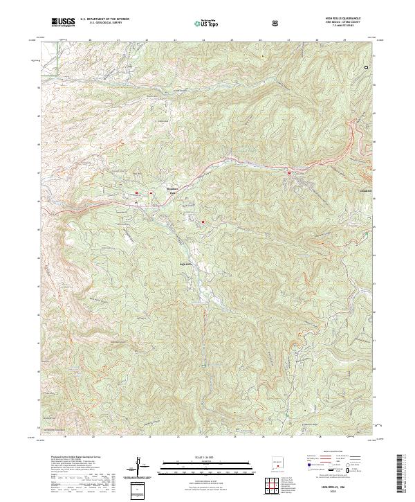
2023 Map of High Rolls
USGS Topo · Published 2023About this map
Mountain Park and High Rolls serve as central points of interest in this high-altitude landscape within the Lincoln National Forest. The map documents a complex network of canyons and gulches, including Sacramento Gulch and Russia Canyon, that define the local topography. Traces of historical land use are evident through features like Old Railroad Rd and Old Fire House Rd, suggesting the area's development around timber or transport infrastructure. Water sources are critical in this environment, marked by numerous named springs such as Goat Ranch Spring, Seven Springs, and Mud Spring. To the east, the map borders Cloudcroft, while the southern reaches are dominated by Benson Ridge and the steep descents of Caballero Canyon. Local history is further preserved in the names of peaks and trails, such as Hershberger Peak and the Courtney Mine Trl.
Find a feature on this map
92 named features on this map. Tap any name to fly to it.
Don’t see what you’re looking for? This feature index may not catch every label — zoom into the map to look around manually.
Map Details
Editions of this 2023 High Rolls Map
This is the sole edition of this map. No revisions or reprints were ever made.
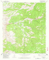
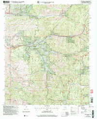
Historical Maps of Mountain Park Through Time
3 maps found