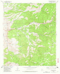
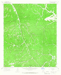
1982 Map of High Rolls
USGS Topo · Published 1982About this map
High Rolls and Mountain Park occupy the high ground of the Sacramento Mountains, where complex topography is marked by the winding path of the Old Railroad Grade. This transit corridor, appearing alongside newer roads, reflects the historical movement of timber and passengers through the steep Fresnal Canyon and Toboggan Canyon. The landscape is a network of canyons and peaks, with local water sources like Maruche Spring and La Luz Spring providing the necessary points for settlement and agriculture within the Lincoln National Forest.
Find a feature on this map
71 named features on this map. Tap any name to fly to it.
Don’t see what you’re looking for? This feature index may not catch every label — zoom into the map to look around manually.
Map Details
Editions of this 1982 High Rolls Map
This is the sole edition of this map. No revisions or reprints were ever made.
Other maps of this area
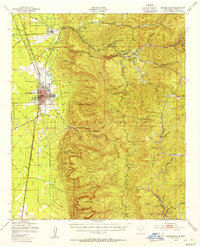
1950 · Alamogordo
USGS Topo · 1:62,500
1950 · Mescalero
USGS Topo · 1:62,500
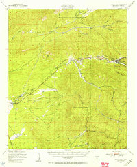
1952 · Cloudcroft
USGS Topo · 1:62,500

1954 · Carlsbad
USGS Topo · 1:250,000

1955 · Roswell
USGS Topo · 1:250,000

1958 · Carlsbad
USGS Topo · 1:250,000

1958 · Roswell
USGS Topo · 1:250,000

1962 · Roswell
USGS Topo · 1:250,000
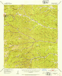
1963 · Firman Canyon
USGS Topo · 1:24,000
1974 · Bluff Springs
USGS Topo · 1:24,000