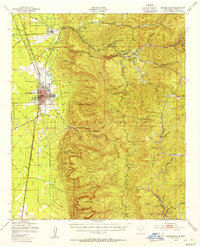
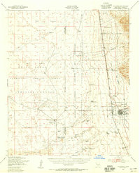
1950 Map of Alamogordo
USGS Topo · Published 1955About this map
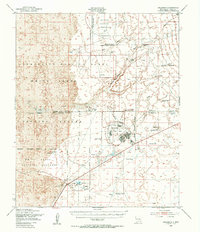
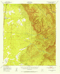
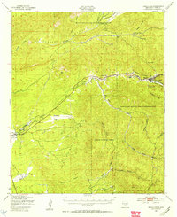
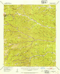
Alamogordo anchors the western edge of this mid-century survey, where the desert floor meets the steep ascent of the Lincoln National Forest. The town's grid is clearly defined, featuring specialized landmarks such as the State Sch For Blind, the Alamogordo Airport, and the Southern Pacific railroad line. To the north, the old settlement of La Luz sits at the mouth of La Luz Canyon, while the high country to the east reveals a different world of winding mountain roads and deep drainages like Fresnal Creek.
Find a feature on this map
58 named features on this map. Tap any name to fly to it.
Don’t see what you’re looking for? This feature index may not catch every label — zoom into the map to look around manually.
Map Details
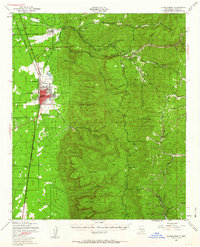
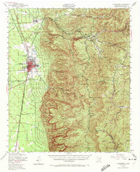
Editions of this 1950 Alamogordo Map
Other maps of this area

1916 · Tularosa
USGS Topo · 1:125,000

1916 · Point Of Sands
USGS Topo · 1:125,000
1948 · Tres Hermanos
USGS Topo · 1:62,500
1948 · Tularosa
USGS Topo · 1:62,500
1948 · Holloman
USGS Topo · 1:62,500
1950 · Escondido Canyon
USGS Topo · 1:62,500
1950 · Mescalero
USGS Topo · 1:62,500
1952 · Cloudcroft
USGS Topo · 1:62,500

1954 · Carlsbad
USGS Topo · 1:250,000

1954 · Tularosa
USGS Topo · 1:250,000