
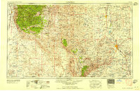
1958 Map of Carlsbad
USGS Topo · Published 1958About this map
Carlsbad Caverns National Park anchors this mid-century survey of the Chihuahuan Desert and the rugged peaks of the Sacramento Mountains. The map reveals a complex water management landscape along the Pecos River, where the Lake McMillan Reservoir and Avalon Lake dominate the arid surroundings near Artesia and Carlsbad. To the west, the high elevations of the Lincoln National Forest provide a sharp contrast to the basin floor, where small ranching outposts and settlements like Dunken and Lakewood dot the terrain. Transportation is defined by the Atchison Topeka and Santa Fe railroad following the river valley, while the Southern Pacific skirts the base of the mountains near Alamogordo. Notable for genealogists is the inclusion of Sacramento City (abandoned), offering a look at early mountain settlements that had already faded by the 1950s.
Find a feature on this map
55 named features on this map. Tap any name to fly to it.
Don’t see what you’re looking for? This feature index may not catch every label — zoom into the map to look around manually.
Map Details
Editions of this 1958 Carlsbad Map
2 editions found
Other maps of this area

1896 · El Paso
USGS Topo · 1:125,000

1903 · Cerro Alto
USGS Topo · 1:125,000

1908 · El Paso
USGS Topo · 1:125,000

1916 · Tularosa
USGS Topo · 1:125,000

1916 · Point Of Sands
USGS Topo · 1:125,000

1925 · Orla 2-b
USGS Topo · 1:48,000

1931 · Orla
USGS Topo · 1:62,500

1933 · Guadalupe Peak
USGS Topo · 1:48,000

1935 · El Paso Gap
USGS Topo · 1:62,500

1936 · El Paso Gap
USGS Topo · 1:48,000