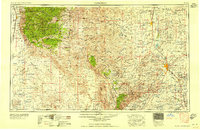
1958 Map of Carlsbad
USGS Topo · Published 1958About this map
The Pecos River corridor defines the eastern industrial and agricultural character of this region, feeding into the Lake McMillan Reservoir and Lake Avalon as it flows south toward Carlsbad. To the east, the landscape supports economic activity such as the Potash Mine, while the western terrain is dominated by the high elevations of the Sacramento Mountains and the Lincoln National Forest (Sacramento Division). The transition from the arid Tularosa Valley to the dramatic heights of the Guadalupe Mountains illustrates the complex topography of the New Mexico-Texas borderlands.
Find a feature on this map
53 named features on this map. Tap any name to fly to it.
Don’t see what you’re looking for? This feature index may not catch every label — zoom into the map to look around manually.
Map Details
Editions of this 1958 Carlsbad Map
2 editions found

Other maps of this area

1896 · El Paso
USGS Topo · 1:125,000

1903 · Cerro Alto
USGS Topo · 1:125,000

1908 · El Paso
USGS Topo · 1:125,000

1916 · Tularosa
USGS Topo · 1:125,000

1916 · Point Of Sands
USGS Topo · 1:125,000

1925 · Orla 2-b
USGS Topo · 1:48,000

1931 · Orla
USGS Topo · 1:62,500

1933 · Guadalupe Peak
USGS Topo · 1:48,000

1935 · El Paso Gap
USGS Topo · 1:62,500

1936 · El Paso Gap
USGS Topo · 1:48,000