
1958 Map of Roswell
USGS Topo · Published 1958About this map
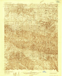
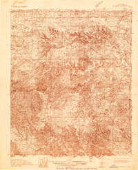
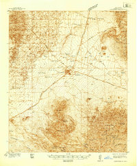
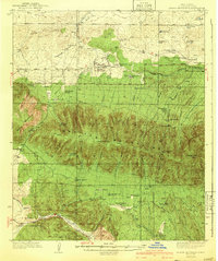
Walker Air Force Base sits east of the city of Roswell, marking a significant military presence in the Chaves County plains during the mid-1950s. The landscape transitions sharply from the high peaks of the Sacramento Mountains and Sierra Blanca, reaching over 12,000 feet, down to the drainage of the Pecos River. This map captures the region when small settlements like Lincoln and White Oaks maintained their historical identities alongside the growth of the Mescalero Apache Indian Reservation.
Find a feature on this map
76 named features on this map. Tap any name to fly to it.
Don’t see what you’re looking for? This feature index may not catch every label — zoom into the map to look around manually.
Map Details
Editions of this 1958 Roswell Map
This is the sole edition of this map. No revisions or reprints were ever made.
Other maps of this area

1916 · Tularosa
USGS Topo · 1:125,000

1916 · Point Of Sands
USGS Topo · 1:125,000

1918 · Oscura Peak
USGS Topo · 1:125,000

1934 · Capitan
USGS Topo · 1:48,000
1935 · Capitan Mountains
USGS Topo · 1:48,000
1936 · Arabela
USGS Topo · 1:48,000

1937 · Capitan
USGS Topo · 1:62,500
1938 · Carrizozo
USGS Topo · 1:48,000
1940 · Capitan Mountains
USGS Topo · 1:62,500

1942 · Arabela
USGS Topo · 1:62,500