
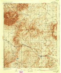
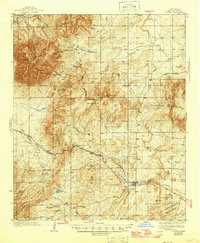
1937 Map of Capitan
USGS Topo · Published 1937About this map
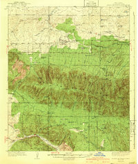
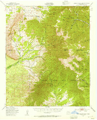
White Oaks and the surrounding Lincoln County highlands appear during a transitional era of ranching and early healthcare infrastructure. Surveyed by Max J. Gleissner and a team of topographers in the mid-1930s, the map reveals a rugged geography defined by the Capitan Mountains and the Sierra Vera Cruz Mountains. The presence of the U. S. Marine Hospital Reservation near the Rio Bonito marks a significant federal footprint in the region, while the Mine Camp in Tortolita Gulch points to the area's ongoing mineral interests. Ranching life is documented through named properties like the Phillips Ranch and Romine Ranch. Transportation follows the Southern Pacific Highway, which threads through the Indian Divide, connecting the settlements of Nogal and Capitan.
Find a feature on this map
50 named features on this map. Tap any name to fly to it.
Don’t see what you’re looking for? This feature index may not catch every label — zoom into the map to look around manually.
Map Details
Editions of this 1937 Capitan Map
3 editions found
Other maps of this area

1934 · Capitan
USGS Topo · 1:48,000
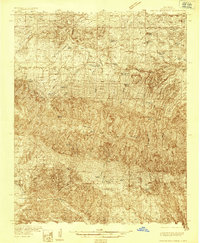
1935 · Capitan Mountains
USGS Topo · 1:48,000
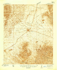
1938 · Carrizozo
USGS Topo · 1:48,000
1940 · Capitan Mountains
USGS Topo · 1:62,500
1943 · Carrizozo
USGS Topo · 1:62,500
1950 · Carrizozo
USGS Topo · 1:62,500
1950 · Little Black Peak
USGS Topo · 1:62,500
1950 · Sierra Blanca Peak
USGS Topo · 1:62,500

1955 · Roswell
USGS Topo · 1:250,000

1958 · Roswell
USGS Topo · 1:250,000