
1955 Map of Roswell
USGS Topo · Published 1974About this map
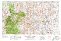
Roswell sits at the heart of this mid-century landscape, positioned where the high plains meet the eastern slopes of the Sacramento Mountains. The map reveals a clear geographic divide between the irrigated agricultural corridor of the Pecos River and the high-elevation ranching and timber country to the west. Along the river, settlements like Dexter, Hagerman, and Lake Arthur follow the Atchison Topeka and Santa Fe RR, supported by a dense network of windmills and wells such as South Mill Well. To the west, the massive blocks of the Lincoln National Forest and the Mescalero Apache Indian Reservation dominate the terrain. Significant landmarks include the volcanic Lava flows near Carrizozo and the unique hydrological features at Bottomless Lakes State Park, including Lea Lake and Devil's Inkwell. This survey also documents the mountain outposts of Ft Stanton and Ruidoso, centers for recreation and ranching at the base of Sierra Blanca Peak.
Find a feature on this map
107 named features on this map. Tap any name to fly to it.
Don’t see what you’re looking for? This feature index may not catch every label — zoom into the map to look around manually.
Map Details
Editions of this 1955 Roswell Map
3 editions found
Other maps of this area

1916 · Tularosa
USGS Topo · 1:125,000

1916 · Point Of Sands
USGS Topo · 1:125,000

1918 · Oscura Peak
USGS Topo · 1:125,000

1934 · Capitan
USGS Topo · 1:48,000

1935 · Capitan Mountains
USGS Topo · 1:48,000

1936 · Arabela
USGS Topo · 1:48,000

1937 · Capitan
USGS Topo · 1:62,500

1938 · Carrizozo
USGS Topo · 1:48,000

1940 · Capitan Mountains
USGS Topo · 1:62,500

1942 · Arabela
USGS Topo · 1:62,500