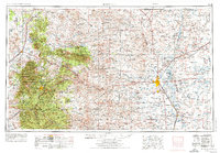
1955 Map of Roswell
USGS Topo · Published 1974About this map
Roswell serves as the eastern anchor of this landscape, situated at the confluence of the Rio Hondo and the Pecos River. The terrain shifts dramatically westward from the river lowlands of the Bitter Lake National Wildlife Refuge toward the massive heights of the Capitan Mountains and the White Mountain Wilderness Area. In the high country, the town of Lincoln marks a region of significant local history, while Ruidoso sits at the edge of the Mescalero Apache Indian Reservation.
Find a feature on this map
157 named features on this map. Tap any name to fly to it.
Don’t see what you’re looking for? This feature index may not catch every label — zoom into the map to look around manually.
Map Details
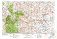
Editions of this 1955 Roswell Map
3 editions found

Other maps of this area

1916 · Tularosa
USGS Topo · 1:125,000

1916 · Point Of Sands
USGS Topo · 1:125,000

1918 · Oscura Peak
USGS Topo · 1:125,000

1934 · Capitan
USGS Topo · 1:48,000

1935 · Capitan Mountains
USGS Topo · 1:48,000

1936 · Arabela
USGS Topo · 1:48,000

1937 · Capitan
USGS Topo · 1:62,500

1938 · Carrizozo
USGS Topo · 1:48,000

1940 · Capitan Mountains
USGS Topo · 1:62,500

1942 · Arabela
USGS Topo · 1:62,500