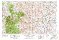
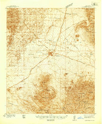
1955 Map of Roswell
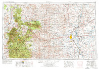
USGS Topo · Published 1974About this map
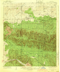
Roswell serves as the eastern anchor for this mid-century New Mexico landscape, where the high plains meet the dramatic rises of the Capitan Mountains and the Sacramento Mountains. The map reveals a region defined by the Pecos River valley, supporting settlements like Dexter and Lake Arthur along the Atchison Topeka and Santa Fe railroad line. To the west, the expansive Lincoln National Forest surrounds historic points of interest such as White Oaks and Ft Stanton, reflecting the area's mining and frontier heritage. The Mescalero Apache Indian Reservation occupies the southwestern quadrant, while the arid landscape is dotted with numerous springs and tanks, including Coyote Spr and Spotted Tank, which were essential for ranching. Conservation and recreation areas like Bitter Lake National Wildlife Refuge and Bottomless Lakes State Park highlight the unique hydrologic features of the Pecos basin.
Find a feature on this map
76 named features on this map. Tap any name to fly to it.
Don’t see what you’re looking for? This feature index may not catch every label — zoom into the map to look around manually.
Map Details
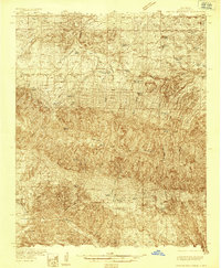
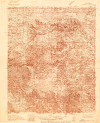
Editions of this 1955 Roswell Map
3 editions found

Other maps of this area

1916 · Tularosa
USGS Topo · 1:125,000

1916 · Point Of Sands
USGS Topo · 1:125,000

1918 · Oscura Peak
USGS Topo · 1:125,000

1934 · Capitan
USGS Topo · 1:48,000
1935 · Capitan Mountains
USGS Topo · 1:48,000
1936 · Arabela
USGS Topo · 1:48,000

1937 · Capitan
USGS Topo · 1:62,500
1938 · Carrizozo
USGS Topo · 1:48,000
1940 · Capitan Mountains
USGS Topo · 1:62,500

1942 · Arabela
USGS Topo · 1:62,500