
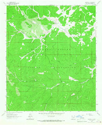
1963 Map of Firman Canyon
USGS Topo · Published 1967About this map
The Mescalero Apache Indian Reservation and the Lincoln National Forest dominate this high-altitude topography in Otero County. Centered on the South Fork Tularosa Canyon, the map reveals a landscape defined by its vital water sources, including Head Springs in the north and Silver Springs in the south. The narrow drainage of the Rio Tularosa cuts through the terrain, flanked by a network of side canyons such as Firman Canyon and Morgan Canyon.
Find a feature on this map
34 named features on this map. Tap any name to fly to it.
Don’t see what you’re looking for? This feature index may not catch every label — zoom into the map to look around manually.
Map Details
Editions of this 1963 Firman Canyon Map
This is the sole edition of this map. No revisions or reprints were ever made.
Other maps of this area

1950 · Alamogordo
USGS Topo · 1:62,500

1950 · Mescalero
USGS Topo · 1:62,500

1952 · Cloudcroft
USGS Topo · 1:62,500

1954 · Carlsbad
USGS Topo · 1:250,000

1955 · Roswell
USGS Topo · 1:250,000

1958 · Carlsbad
USGS Topo · 1:250,000

1958 · Roswell
USGS Topo · 1:250,000

1962 · Roswell
USGS Topo · 1:250,000

1963 · Apache Summit
USGS Topo · 1:24,000
1963 · Whitetail
USGS Topo · 1:24,000