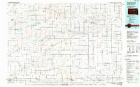
1985 Map of Highmore
USGS Topo · Published 1988About this map
Highmore and Miller anchor this mid-1980s landscape, illustrating the agricultural and transit patterns across Hyde, Hand, and Sully counties. The Chicago and North Western railroad forms a rigid horizontal spine through the southern townships, connecting the settlements of Blunt, Harrold, Holabird, and Ree Heights. This rail-oriented corridor contrasts with the scattered landing strips, such as the Nelson and Myers strips, reflecting the importance of private aviation for rural connectivity in the late twentieth century.
Find a feature on this map
74 named features on this map. Tap any name to fly to it.
Don’t see what you’re looking for? This feature index may not catch every label — zoom into the map to look around manually.
Map Details
Editions of this 1985 Highmore Map
3 editions found
Other maps of this area

1899 · Northville
USGS Topo · 1:125,000

1899 · Redfield
USGS Topo · 1:125,000

1934 · Canning
USGS Topo · 1:48,000

1937 · Canning
USGS Topo · 1:62,500

1949 · Ree Heights NW
USGS Topo · 1:24,000

1949 · Mitchell Lake
USGS Topo · 1:24,000

1950 · Ree Heights SE
USGS Topo · 1:24,000

1950 · Highmore NE
USGS Topo · 1:24,000

1950 · Mitchell Lake
USGS Topo · 1:24,000

1950 · Highmore
USGS Topo · 1:24,000