2022 Map of Hillisburg
USGS Topo · Published 2022About this map
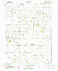
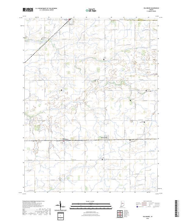
Hillisburg and Scireleville anchor this agricultural landscape in Clinton County, where the pattern of straight county roads reveals the systematic division of the Indiana countryside. The map traces a complex network of drainage infrastructure essential to the region's farming legacy, including Stump Ditch, Davis Ditch, and Paris Ditch. For genealogists and local historians, the sheet is particularly valuable for its density of family-named burial grounds, such as Plummer Cem, Veneman Cem, and Bacon Cem, which are scattered throughout the rural townships. Larger watercourses like Kilmore Creek and the S Fork Wildcat Cr provide natural breaks in the grid, while the northern edge of the survey captures the small settlement of Forest near the Howard County line.
Find a feature on this map
55 named features on this map. Tap any name to fly to it.
Don’t see what you’re looking for? This feature index may not catch every label — zoom into the map to look around manually.
Map Details
Editions of this 2022 Hillisburg Map
This is the sole edition of this map. No revisions or reprints were ever made.