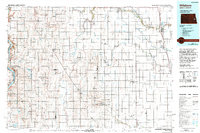
1985 Map of Hillsboro
USGS Topo · Published 1994About this map
Hillsboro and Mayville anchor the eastern agricultural corridor of this mid-1980s survey, a region defined by the intricate drainage systems of the Red River Valley. The Goose River and its various branches meander through townships like Roseville and Norway, while the Burlington Northern railroad provides the primary industrial spine connecting settlements such as Blanchard, Kelso, and Grandin. To the west, the landscape shifts toward the significant water resources of the Sheyenne River and Lake Ashtabula, which are surrounded by conservation lands including the Baldhill Reservoir State Wildlife Mgmt Area. This map reveals a highly organized rural infrastructure, where small prairie towns like Galesburg, Hope, and Page are situated at regular intervals along the rail lines and county boundaries. The presence of numerous gaging stations and drains, such as Miller Drain and Blanchard Drain No 23, illustrates the region's intensive water management essential for its fertile farmland.
Find a feature on this map
113 named features on this map. Tap any name to fly to it.
Don’t see what you’re looking for? This feature index may not catch every label — zoom into the map to look around manually.
Map Details
Editions of this 1985 Hillsboro Map
2 editions found
Other maps of this area

1895 · Fargo
USGS Topo · 1:125,000

1895 · Casselton
USGS Topo · 1:125,000

1897 · Fargo
USGS Topo · 1:125,000

1897 · Tower
USGS Topo · 1:125,000

1897 · Eckelson
USGS Topo · 1:125,000

1897 · Casselton
USGS Topo · 1:125,000

1918 · Kelso
USGS Topo · 1:62,500

1918 · Hendrum
USGS Topo · 1:62,500

1919 · Eldred
USGS Topo · 1:62,500

1943 · Kelso
USGS Topo · 1:62,500