2022 Map of Hillsboro
USGS Topo · Published 2022About this map
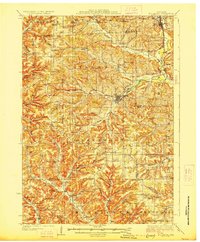
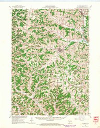
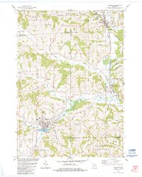
Hillsboro sits at the junction of several key valleys in this southwestern Wisconsin survey, where the W Br Baraboo River and South Branch Creek meet. The map reveals a landscape defined by sharp elevation changes and numerous family-named landmarks like Tinkers Bluff, Kimballs Bluff, and The Pinnacle. These topographical features separate the valley settlements of Elroy and Union Center, which are linked by the 400 State Trl, a recreational path following an old rail corridor along the Baraboo River.
Find a feature on this map
128 named features on this map. Tap any name to fly to it.
Don’t see what you’re looking for? This feature index may not catch every label — zoom into the map to look around manually.
Map Details
Editions of this 2022 Hillsboro Map
This is the sole edition of this map. No revisions or reprints were ever made.
Historical Maps of Greenwood Through Time
4 maps found