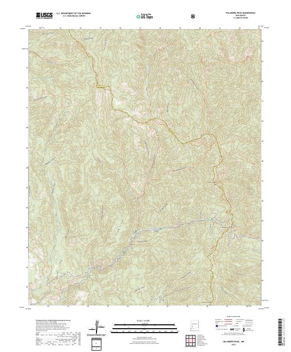
2023 Map of Hillsboro Peak
USGS Topo · Published 2023About this map
Emory Pass and the high ridges of the Black Range dominate this study of the divide between Grant and Sierra counties. Centered on the protected landscapes of the Gila National Forest and the Aldo Leopold Wilderness, the map documents a complex system of drainage and trails. Distinctive elevations like Cross-O Mtn and Sawyers Peak overlook a series of steep drainages including Bull Trap Canyon, Noonday Canyon, and the various branches of the Animas Creek system. The network of historical paths, such as the Animas Divide Trl and the Black Range Crest Trl, follows the natural contours of the land, providing a clear record of high-altitude passage through this southwestern wilderness.
Find a feature on this map
47 named features on this map. Tap any name to fly to it.
Don’t see what you’re looking for? This feature index may not catch every label — zoom into the map to look around manually.
Map Details
Editions of this 2023 Hillsboro Peak Map
This is the sole edition of this map. No revisions or reprints were ever made.
Other maps of this area

1935 · Hillsboro
USGS Topo · 1:48,000

1940 · Hillsboro
USGS Topo · 1:62,500

1954 · Tularosa
USGS Topo · 1:250,000

1955 · Las Cruces
USGS Topo · 1:250,000

1956 · San Lorenzo
USGS Topo · 1:62,500

1958 · Las Cruces
USGS Topo · 1:250,000

1958 · Tularosa
USGS Topo · 1:250,000
1963 · Hay Mesa
USGS Topo · 1:24,000

1963 · Victoria Park
USGS Topo · 1:24,000

1963 · Apache Peak
USGS Topo · 1:24,000