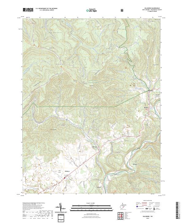
2023 Map of Hillsboro
USGS Topo · Published 2023About this map
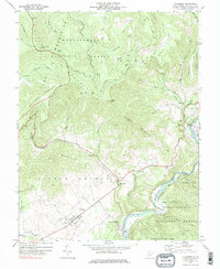
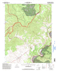
The Little Levels region of West Virginia anchors this modern survey, highlighting a distinctive high-altitude agricultural basin surrounded by the Monongahela National Forest. The settlement at Hillsboro sits at the heart of this landscape, where the terrain transitions from the dramatic peaks of the Yew Mountains and Cranberry Mountain into fertile bottomlands. These valleys are defined by an intricate network of springs and runs, such as Cave Spring and Blue Spring, which feed into the Greenbrier River as it winds past Watoga and Seebert.
Find a feature on this map
85 named features on this map. Tap any name to fly to it.
Don’t see what you’re looking for? This feature index may not catch every label — zoom into the map to look around manually.
Map Details
Editions of this 2023 Hillsboro Map
This is the sole edition of this map. No revisions or reprints were ever made.
Historical Maps of Violet Through Time
3 maps found