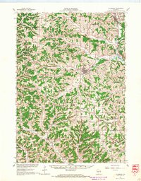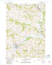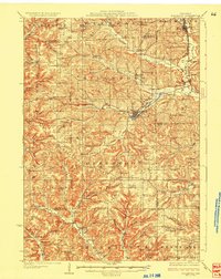
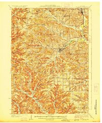
1927 Map of Hillsboro
USGS Topo · Published 1927About this map
The Baraboo River and its numerous branches, such as the South Fork Baraboo River, carve a dense network of ridges and valleys across this 1920s landscape. The settlement of Hillsboro serves as a central hub, connected to Union Center by the Chicago and Northeastern Ry. This era shows a rural society organized around tightly spaced neighborhood landmarks, with dozens of local institutions like the Knowlton School, Cheyenne School, and Miller's Prairie School serving family farms tucked into draws like Barton Hollow and McKenzie Valley.
Find a feature on this map
102 named features on this map. Tap any name to fly to it.
Don’t see what you’re looking for? This feature index may not catch every label — zoom into the map to look around manually.
Map Details
Editions of this 1927 Hillsboro Map
2 editions found
Historical Maps of Elroy Through Time
8 maps found