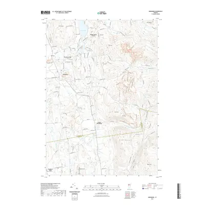
2021 Map of Hinesburg
USGS Topo · Published 2021About this map
Hinesburg and its surrounding village clusters represent a traditional Vermont valley landscape shaped by the La Platte River and Patrick Brook. The settlement pattern at Mechanicsville and South Hinesburg follows the transition from fertile lowlands into the rising elevations of the Green Mountains and the Hogback Mountains. This 2021 update shows the modern road network, including names like Billings Farm Rd and Ski Lodge Dr, which hint at the region's agricultural history and recreational development. Genealogists will find several burial sites well-preserved in the survey, including the Barker Cem, Hinesburg Cem, and the McDonough Cem near the Chittenden Co and Addison Co border. Natural landmarks such as Lake Iroquois and the peak of Mt Pritchard anchor the northern reaches of the quadrangle.
Find a feature on this map
125 named features on this map. Tap any name to fly to it.
Don’t see what you’re looking for? This feature index may not catch every label — zoom into the map to look around manually.
Map Details
Editions of this 2021 Hinesburg Map
This is the sole edition of this map. No revisions or reprints were ever made.
Other maps of this area

1903 · Middlebury
USGS Topo · 1:62,500

1905 · Middlebury
USGS Topo · 1:62,500

1906 · Burlington
USGS Topo · 1:62,500

1919 · Burlington
USGS Topo · 1:62,500

1919 · Lincoln Mountain
USGS Topo · 1:62,500

1920 · Lincoln Mountain
USGS Topo · 1:48,000

1920 · Middlebury
USGS Topo · 1:62,500

1921 · Richmond
USGS Topo · 1:48,000

1921 · Lincoln Mountain
USGS Topo · 1:62,500

1924 · Camels Hump
USGS Topo · 1:62,500