
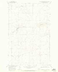
1969 Map of Hingham
USGS Topo · Published 1972About this map
Hingham sits as a central hub for the surrounding wheat country in north-central Montana during the late 1960s. The landscape is defined by the high-plains topography of Hill County, where the iron of the Burlington Northern railroad runs east-west, providing the vital link between local grain production and distant markets. This rail corridor serves as the town's spine, around which the primary settlement and industrial footprints are clustered. Just south of the town center, a Landing Strip and Sewage Disposal Ponds mark the modest modern infrastructure of this rural community.
Find a feature on this map
7 named features on this map. Tap any name to fly to it.
Don’t see what you’re looking for? This feature index may not catch every label — zoom into the map to look around manually.
Map Details
Editions of this 1969 Hingham Map
This is the sole edition of this map. No revisions or reprints were ever made.
Other maps of this area

1919 · Big Sandy
USGS Topo · 1:125,000

1919 · Alma
USGS Topo · 1:125,000

1920 · Gildford
USGS Topo · 1:125,000

1943 · Gildford
USGS Topo · 1:125,000

1954 · Shelby
USGS Topo · 1:250,000

1958 · Shelby
USGS Topo · 1:250,000

1969 · Gildford NE
USGS Topo · 1:24,000

1969 · Gildford NW
USGS Topo · 1:24,000

1969 · Fourteenmile Coulee NW
USGS Topo · 1:24,000
1969 · Fourteenmile Coulee NE
USGS Topo · 1:24,000