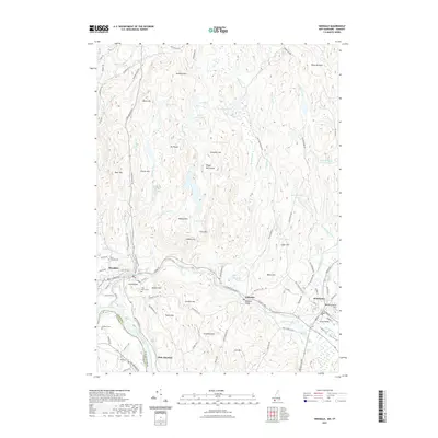
2021 Map of Hinsdale
USGS Topo · Published 2021About this map
The Ashuelot River carves a central corridor through this New Hampshire terrain, connecting the industrial and residential hubs of Hinsdale, Ashuelot, and Winchester. The topography is defined by the Pisgah Mtn Range and numerous summits like Mt Pisgah and Cat Den Mtn, punctuated by a complex network of upland water bodies including Fullam Pond and North Round Pond. In the southwest, the Connecticut River forms the state boundary with Vermont near Dole Junction. Local history is anchored by several historic burial grounds, such as Pine Grove Cem and Saint Josephs Cem, alongside the iconic Ashuelot Bridge. The map details a landscape where steep hills like Meetinghouse Hill overlook narrow river valleys that have long shaped the settlement patterns and transport routes of Cheshire County.
Find a feature on this map
113 named features on this map. Tap any name to fly to it.
Don’t see what you’re looking for? This feature index may not catch every label — zoom into the map to look around manually.
Map Details
Editions of this 2021 Hinsdale Map
This is the sole edition of this map. No revisions or reprints were ever made.
Other maps of this area

1887 · Warwick
USGS Topo · 1:62,500

1889 · Warwick
USGS Topo · 1:62,500

1890 · Greenfield
USGS Topo · 1:62,500

1891 · Brattleboro
USGS Topo · 1:62,500

1893 · Brattleboro
USGS Topo · 1:62,500

1894 · Greenfield
USGS Topo · 1:62,500

1894 · Warwick
USGS Topo · 1:62,500

1898 · Keene
USGS Topo · 1:62,500

1932 · Brattleboro
USGS Topo · 1:48,000

1932 · Warwick
USGS Topo · 1:48,000