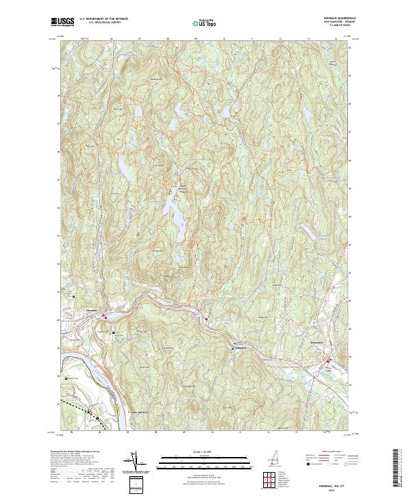
2024 Map of Hinsdale
USGS Topo · Published 2024About this map
Hinsdale and Winchester anchor this corridor where the Ashuelot River flows westward to meet the Connecticut River. The landscape is defined by the steep rises of the Pisgah Mountain Range and Mt Pisgah, framing a network of highlands that includes Cat Den Mtn, Tower Hill, and Gun Mtn. While the primary settlements sit along the riverbanks, the surrounding hills are dotted with remote water bodies like Fullam Pond, North Round Pond, and the significant Pisgah Reservoir.
Find a feature on this map
133 named features on this map. Tap any name to fly to it.
Don’t see what you’re looking for? This feature index may not catch every label — zoom into the map to look around manually.
Map Details
Editions of this 2024 Hinsdale Map
This is the sole edition of this map. No revisions or reprints were ever made.
Other maps of this area

1887 · Warwick
USGS Topo · 1:62,500

1889 · Warwick
USGS Topo · 1:62,500

1890 · Greenfield
USGS Topo · 1:62,500

1891 · Brattleboro
USGS Topo · 1:62,500

1893 · Brattleboro
USGS Topo · 1:62,500

1894 · Greenfield
USGS Topo · 1:62,500

1894 · Warwick
USGS Topo · 1:62,500

1898 · Keene
USGS Topo · 1:62,500

1932 · Brattleboro
USGS Topo · 1:48,000

1932 · Warwick
USGS Topo · 1:48,000