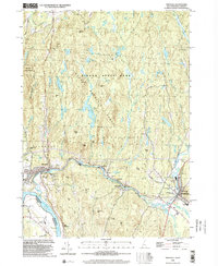
1998 Map of Hinsdale
USGS Topo · Published 2002About this map
The Ashuelot River flows westward through the southern portion of this landscape, meeting the Connecticut River at the border between New Hampshire and Vermont. This late-twentieth-century survey illustrates the corridor of the Vermont Central RR as it follows the river valley through Hinsdale and on toward Dole Junction. The northern half of the region is dominated by the Pisgah Mountain Range, much of which is protected within Pisgah State Park.
Find a feature on this map
65 named features on this map. Tap any name to fly to it.
Don’t see what you’re looking for? This feature index may not catch every label — zoom into the map to look around manually.
Map Details
Editions of this 1998 Hinsdale Map
This is the sole edition of this map. No revisions or reprints were ever made.
Other maps of this area

1887 · Warwick
USGS Topo · 1:62,500

1889 · Warwick
USGS Topo · 1:62,500

1890 · Greenfield
USGS Topo · 1:62,500

1891 · Brattleboro
USGS Topo · 1:62,500

1893 · Brattleboro
USGS Topo · 1:62,500

1894 · Greenfield
USGS Topo · 1:62,500

1894 · Warwick
USGS Topo · 1:62,500

1898 · Keene
USGS Topo · 1:62,500

1932 · Brattleboro
USGS Topo · 1:48,000

1932 · Warwick
USGS Topo · 1:48,000