2022 Map of Hiwassee
USGS Topo · Published 2022About this map
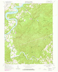
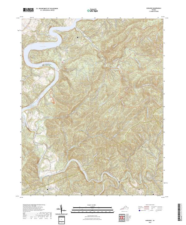
The New River and its expansive Claytor Lake impoundment dominate this portion of Pulaski County, where the water cuts deep through the mountainous terrain of southwest Virginia. The landscape is a network of ridges and hollows, evidenced by prominent features like Chimney Mountain Trl and Gator Mountain Rd. Small, family-named burial grounds including Hurst Cem, Simpkins Cem, and Marshall Cem are scattered across the uplands, providing essential touchstones for genealogical research in this rural corridor. The New River Trl follows the river's winding course, tracing a historic transportation route that once served as a primary artery through the valley. To the south, the terrain becomes increasingly intricate as Big Reed Island Creek and Little Reed Island Creek converge near the county boundaries, surrounded by local landmarks like Mabe Hollow Ln and Jersey Ridge Trl.
Find a feature on this map
103 named features on this map. Tap any name to fly to it.
Don’t see what you’re looking for? This feature index may not catch every label — zoom into the map to look around manually.
Map Details
Editions of this 2022 Hiwassee Map
This is the sole edition of this map. No revisions or reprints were ever made.