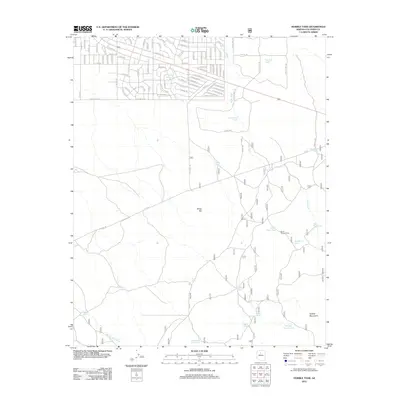
2012 Map of Hobble Tank
USGS Topo · Published 2012About this map
Winter Camp and Hardy Winter Camp sit within a high-desert landscape defined by a critical network of water catchment systems. In this arid reach of Coconino County, the placement of features like Hobble Tank, Big Hole Tank, and Little Hocter Tank reveals the essential infrastructure required for ranching and survival in the Arizona backcountry. The terrain is marked by prominent landforms such as White Hill and the Hobble Mountains, with drainage provided by the seasonal courses of Miller Wash and Spring Valley Wash. A dense residential street grid in the northwestern corner, featuring names like Waddell Rd and Palmdale Rd, contrasts sharply with the open range and numerous isolated tanks like Lonesome Knob Tank and Chaparral Tank that dominate the rest of the quadrangle.
Find a feature on this map
102 named features on this map. Tap any name to fly to it.
Don’t see what you’re looking for? This feature index may not catch every label — zoom into the map to look around manually.
Map Details
Editions of this 2012 Hobble Tank Map
This is the sole edition of this map. No revisions or reprints were ever made.
Other maps of this area

1886 · San Francisco Mtns
USGS Topo · 1:250,000

1886 · Chino
USGS Topo · 1:250,000

1891 · San Francisco Mtns
USGS Topo · 1:250,000

1891 · Chino
USGS Topo · 1:250,000

1894 · San Francisco Mtns
USGS Topo · 1:250,000

1899 · San Francisco Mtns
USGS Topo · 1:250,000

1908 · Flagstaff
USGS Topo · 1:125,000

1912 · Flagstaff
USGS Topo · 1:125,000

1922 · Williams
USGS Topo · 1:125,000

1947 · Flagstaff
USGS Topo · 1:250,000