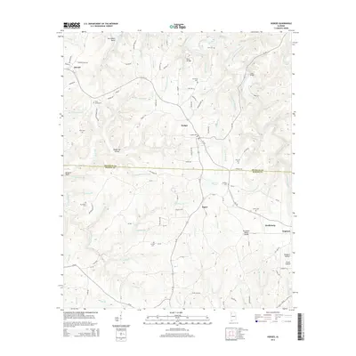
2014 Map of Hodges
USGS Topo · Published 2014About this map
The Tennessee Valley Divide cuts through this corner of northwestern Alabama, shaping a landscape of deep hollows and winding creek branches. The settlements of Hodges and Hackleburg anchor a region defined by its complex topography, where the Bear Cr Reservoir and its numerous tributaries, such as Bull Mountain Cr and Lawler Mill Br, flow through the terrain. A dense network of local cemeteries, including Holly Springs Cem, Mt Carmel Cem, and Mt Zion Cem, are distributed across the countryside, offering significant data points for genealogical research. Prominent natural landmarks like Rock Bridge and Buzzard Bluff stand alongside early 21st-century infrastructure, while the small community of Pigeye and the Railroad Pond provide evidence of the local history and industry that once thrived in the area between the Franklin and Marion county lines.
Find a feature on this map
124 named features on this map. Tap any name to fly to it.
Don’t see what you’re looking for? This feature index may not catch every label — zoom into the map to look around manually.
Map Details
Editions of this 2014 Hodges Map
This is the sole edition of this map. No revisions or reprints were ever made.
Other maps of this area

1936 · Hodges
USGS Topo · 1:24,000

1936 · Isbell
USGS Topo · 1:24,000

1936 · South Of Hackleburg
USGS Topo · 1:24,000

1936 · Hackleburg
USGS Topo · 1:24,000

1936 · Vina
USGS Topo · 1:24,000

1936 · Halltown
USGS Topo · 1:24,000

1936 · Guinn Cross Roads
USGS Topo · 1:24,000
1945 · Isbell
USGS Topo · 1:24,000

1946 · Hackleburg
USGS Topo · 1:24,000
1946 · Guinn Cross Roads
USGS Topo · 1:24,000