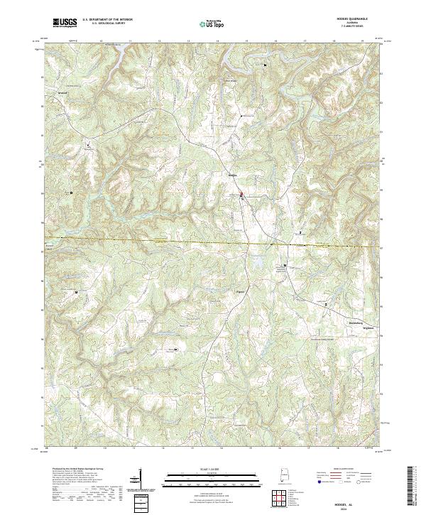
2024 Map of Hodges
USGS Topo · Published 2024About this map
Hodges and the surrounding borderlands of Franklin Co and Marion Co occupy a landscape defined by the Tennessee Valley Divide, where waters split between north-flowing streams like Bear Creek and those feeding southern basins. This modern survey reveals a rural territory anchored by small settlements such as Atwood, Pigeye, and Wiginton, alongside the larger community of Hackleburg on the eastern edge. The map is particularly valuable for genealogists, as it meticulously identifies numerous local burial grounds, including the Old Line Cem, Holly Springs Cem, and the Mount Olive Missionary Baptist Cem. Natural landmarks like Rock Bridge and Buzzard Bluff stand out against a network of drainages such as Skirum Creek and Bull Mountain Creek, while the PD rail line cuts through the central corridor, marking the historical and modern transportation spine of this upland Alabama region.
Find a feature on this map
128 named features on this map. Tap any name to fly to it.
Don’t see what you’re looking for? This feature index may not catch every label — zoom into the map to look around manually.
Map Details
Editions of this 2024 Hodges Map
This is the sole edition of this map. No revisions or reprints were ever made.
Other maps of this area

1936 · Hodges
USGS Topo · 1:24,000

1936 · Isbell
USGS Topo · 1:24,000

1936 · South Of Hackleburg
USGS Topo · 1:24,000

1936 · Hackleburg
USGS Topo · 1:24,000

1936 · Vina
USGS Topo · 1:24,000

1936 · Halltown
USGS Topo · 1:24,000

1936 · Guinn Cross Roads
USGS Topo · 1:24,000
1945 · Isbell
USGS Topo · 1:24,000

1946 · Hackleburg
USGS Topo · 1:24,000
1946 · Guinn Cross Roads
USGS Topo · 1:24,000