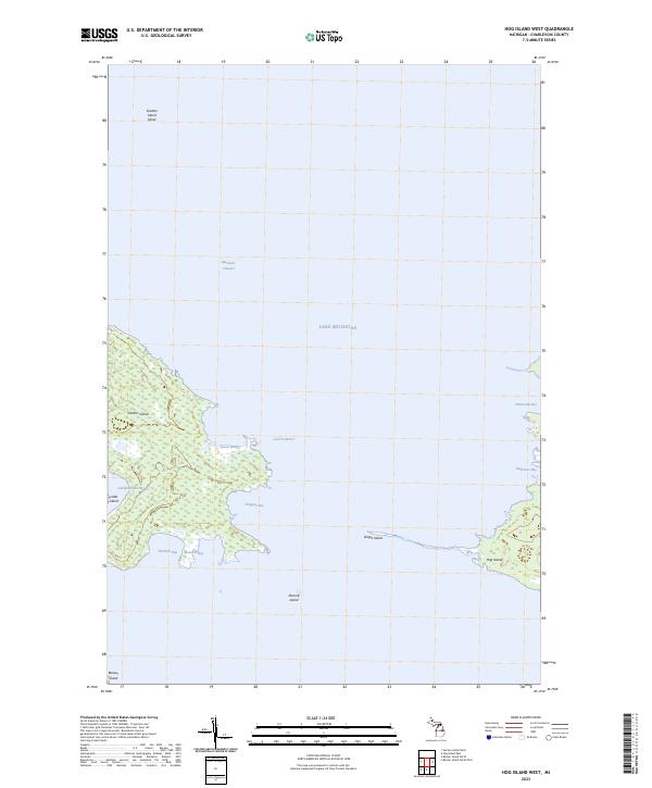
2023 Map of Hog Island West
USGS Topo · Published 2023About this map
Lake Michigan surrounds a cluster of remote landforms in Charlevoix County, defining the intricate coastal geography of the Beaver Island archipelago. This 2023 survey details the complex wetland margins and indented coastlines of Garden Island, which is characterized by numerous protected inlets including Garden Island Harbor, Larsen Harbor, and Jensen Harbor. The map highlights the navigational relationship between these terrestrial features and the submerged Garden Island Shoal to the north, along with the deep waters of the Mackinac Channel. To the southeast, the narrow profile of Grape Island and the larger mass of Hog Island enclose the expansive Sturgeon Bay. These islands, including smaller outcrops like Pismire Island and Little Island, provide a modern look at the shifting shorelines and maritime hazards found in these northern waters. Genealogists and historians can use these precise boundaries to trace land divisions within T39N R9W and T40N R10W in this isolated island chain.
Find a feature on this map
21 named features on this map. Tap any name to fly to it.
Don’t see what you’re looking for? This feature index may not catch every label — zoom into the map to look around manually.
Map Details
Editions of this 2023 Hog Island West Map
This is the sole edition of this map. No revisions or reprints were ever made.
Other maps of this area

1955 · Hog Island
USGS Topo · 1:62,500

1955 · Cheboygan
USGS Topo · 1:250,000

1956 · Beaver Island
USGS Topo · 1:62,500

1958 · Cheboygan
USGS Topo · 1:250,000
1980 · Garden Island West
USGS Topo · 1:24,000

1984 · Beaver Island
USGS Topo · 1:100,000

1986 · Beaver Island North
USGS Topo · 1:24,000
1986 · Hog Island West
USGS Topo · 1:24,000
1986 · Hog Island East
USGS Topo · 1:24,000

2011 · Beaver Island North OE E
USGS Topo · 1:24,000