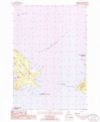
1986 Map of Hog Island West
USGS Topo · Published 1986About this map
Garden Island and Hog Island anchor this mid-1980s look at the northern reaches of Lake Michigan. Much of the land is preserved within the Mackinaw State Forest Garden Island and Mackinaw State Forest Hog Island, highlighting a landscape largely dedicated to conservation and natural management. The intricate shorelines of these islands are defined by small, protected coves like Larsen Harbor, Jensen Harbor, and Garden Island Harbor, which offer insight into the natural anchorages available in these waters. Small satellite features like Pismire Island and Grape Island further illustrate the fragmented archipelago. The presence of the Michigan Islands National Wildlife Refuge underscores the ecological importance of this area as a sanctuary for migratory birds and local wildlife within Lake Michigan.
Find a feature on this map
20 named features on this map. Tap any name to fly to it.
Don’t see what you’re looking for? This feature index may not catch every label — zoom into the map to look around manually.
Map Details
Editions of this 1986 Hog Island West Map
This is the sole edition of this map. No revisions or reprints were ever made.
Other maps of this area

1955 · Hog Island
USGS Topo · 1:62,500

1955 · Cheboygan
USGS Topo · 1:250,000

1956 · Beaver Island
USGS Topo · 1:62,500

1958 · Cheboygan
USGS Topo · 1:250,000
1980 · Garden Island West
USGS Topo · 1:24,000

1984 · Beaver Island
USGS Topo · 1:100,000

1986 · Beaver Island North
USGS Topo · 1:24,000
1986 · Hog Island East
USGS Topo · 1:24,000

2011 · Beaver Island North OE E
USGS Topo · 1:24,000
2011 · Hog Island West
USGS Topo · 1:24,000