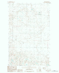
1984 Map of Hogeland
USGS Topo · Published 1984About this map
Hogeland sits as the central point of activity in this northern Blaine County landscape during the late 1970s. The region is defined by a vast network of drainage patterns and intermittent watercourses, most notably the winding path of Murphy Coulee which carves through the undulating plains. Surveyed just south of the Canadian border, this area reflects the spatial organization of the Big Flat region, where section lines and local roads intersect to support a distributed agricultural community. The map reveals the intricate topography of the high plains, capturing a moment when the rural infrastructure of northern Montana remained tied to the land's natural contours and seasonal water flows.
Find a feature on this map
4 named features on this map. Tap any name to fly to it.
Don’t see what you’re looking for? This feature index may not catch every label — zoom into the map to look around manually.
Map Details
Editions of this 1984 Hogeland Map
This is the sole edition of this map. No revisions or reprints were ever made.
Other maps of this area

1903 · Wayne Creek
USGS Topo · 1:62,500

1905 · Wayne Creek
USGS Topo · 1:62,500

1905 · Harlem
USGS Topo · 1:62,500

1913 · Cherry Ridge
USGS Topo · 1:125,000

1953 · Havre
USGS Topo · 1:250,000

1957 · Havre
USGS Topo · 1:250,000

1958 · Havre
USGS Topo · 1:250,000

1984 · Hogeland SE
USGS Topo · 1:24,000
1984 · Wayne Creek NW
USGS Topo · 1:24,000
1984 · Aubrey Dam
USGS Topo · 1:24,000